
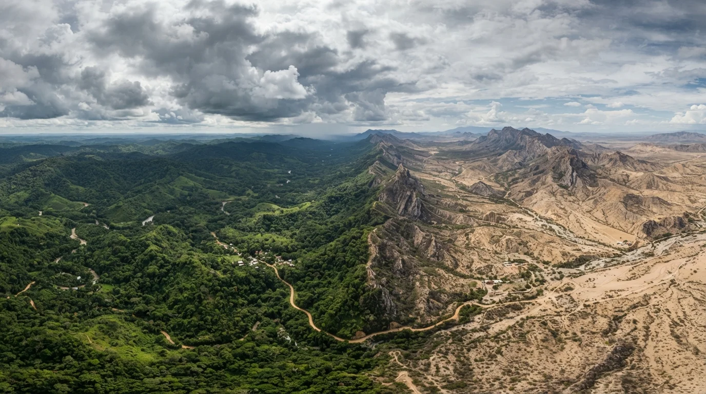
Why Climate Research Belongs in Early Trip Planning
Most travelers check the weather a few days before departure. That's useful for a forecast - but it's too late to inform the decisions that actually shape a trip: which weeks to book, what activities to prioritize, what to pack, and whether a destination's conditions match your comfort and expectations.
Climate research - distinct from a weather forecast - looks at historical patterns over years or decades. It tells you what conditions are probable, not what's certain. That distinction matters. A destination marketed as sunny year-round may have a well-documented rainy stretch in a particular month. A supposedly mild temperate city may have a brutal humidity spike in midsummer that averages don't convey well.
Understanding these patterns before you commit to dates and bookings gives you agency. You can choose to travel during a shoulder period with manageable weather, plan indoor alternatives for likely rain windows, or simply set accurate expectations so conditions don't feel like a disappointment. This kind of preparation also pairs naturally with broader destination research - for example, understanding how geography shapes regional conditions, as explored in Italy's regional geography and its effect on travel.
Climate Data Is Historical, Not a Guarantee
All published climate data - averages, seasonal norms, precipitation charts - reflects past patterns. Actual conditions at the time of your trip may differ due to weather variability, climate shifts, or unusual events. Always check a short-range forecast closer to departure and verify entry or activity requirements with official sources before you travel.
The steps below walk through how to gather, interpret, and apply climate data before you finalize any trip.
Tools and Sources You'll Need
Reliable climate research doesn't require specialized software - but it does require going beyond a single Google search. The most useful sources combine authoritative historical data with real-world context.
What you will need
National meteorological agency websites
Provide authoritative historical climate data, including monthly rainfall averages and temperature ranges, for destinations worldwide.
Climate chart databases (e.g., government or university-hosted)
Offer multi-decade climate averages broken down by month, helping you identify seasonal patterns rather than relying on a single year.
Topographic or elevation maps
Help you identify altitude differences and geographic features that create microclimates within your destination.
Travel forums and destination blogs
Supply real-world accounts of what conditions actually felt like during the same month, complementing statistical climate data.
Cross-Reference at Least Two Climate Sources
No single source tells the full story. Pairing a climate chart from a meteorological database with recent traveler accounts from travel forums or destination-specific blogs gives you both the statistical baseline and real-world texture. Look for posts from the same month you plan to visit, not just the same season.
Once you have these resources in place, the research process moves quickly. The goal isn't exhaustive meteorological study - it's building enough of a picture to make informed decisions about timing, gear, and itinerary structure.
Step-by-Step: Reading Climate Data for Any Destination
Follow these steps in order. Each builds on the last, moving from broad classification to specific, actionable insight.
Identify your destination's climate classification
Start by determining what broad climate zone your destination falls into. The Köppen climate classification system - widely referenced by geographers and meteorologists - divides the world into tropical, arid, temperate, continental, and polar zones, each with distinct sub-types. Knowing where your destination sits helps you interpret everything else you'll read about it.
A quick search for your destination plus terms like "climate type" or "Köppen classification" will usually surface reliable results from university geography departments or national weather services.
Pull monthly climate averages for your travel window
Look up average high and low temperatures, average rainfall in millimeters or inches, and average number of rain days per month for each month you plan to be there. This data is available from national meteorological agencies and university climate databases.
Pay close attention to the number of rain days, not just total rainfall volume. A destination might record high monthly rainfall concentrated in short daily afternoon showers - common in tropical regions - versus prolonged overcast periods more typical of northern European winters. These feel very different on the ground.
Factor in humidity and the heat index
A temperature reading alone can be misleading. At 85°F, a destination with 90% relative humidity will feel substantially more oppressive than one with 40% humidity. Many climate data sites publish average relative humidity by month; look for this alongside temperature figures.
The heat index - sometimes called apparent temperature - combines temperature and humidity into a single felt-temperature figure. Similarly, wind chill affects cold destinations. Understanding these combined measures helps you pack appropriately and manage activity plans.
Research microclimates within the destination
Many destinations contain internal climate variation that aggregate data won't capture. Coastal areas often benefit from sea breezes that moderate temperature. Mountain-facing slopes receive dramatically more rainfall than leeward sides of the same range. Urban centers run warmer than surrounding countryside due to the heat island effect.
If your itinerary takes you across a single island, a mountain range, or between a city and a rural area, look up conditions for each distinct zone separately. This is especially relevant for destinations like Hawaii, the Caribbean, or anywhere with significant topographic relief. See also: why the same Caribbean island can feel completely different depending on where you stay.
Check for seasonal weather events and extremes
Beyond typical monthly averages, identify whether your destination experiences distinct weather events tied to specific seasons: monsoon rains, hurricane season, dry-season dust winds, wildfire smoke, or severe cold snaps. These events may not dominate the averages but can define the traveler experience during that window.
Government travel advisory pages and destination tourism boards often publish this information. For a broader picture of how seasonal timing shapes the destination experience, shoulder season travel often offers a middle ground between extreme conditions and peak-season crowds.
Translate climate findings into packing and itinerary decisions
Once you have a clear picture of expected conditions, make concrete adjustments. If afternoon rain is likely, schedule outdoor activities in the morning. If humidity is high, prioritize breathable, moisture-wicking fabrics. If altitude is a factor, build acclimatization days into the schedule rather than hitting demanding hikes immediately after arrival.
Climate awareness feeds directly into itinerary construction. A well-structured itinerary accounts for weather windows, not just attractions. For guidance on building that structure, see the anatomy of a well-built travel itinerary.
Altitude Can Catch Visitors Off Guard
Cities at high elevation - such as those in the Andes, the Ethiopian Highlands, or parts of the American West - can feel significantly colder than surrounding lowland areas, even in summer months. Altitude also affects humidity and UV exposure. If your destination sits above 8,000 feet, factor acclimatization time into your itinerary and consult a healthcare provider about altitude-related health considerations before you go.
Putting It All Together Before You Book
Climate awareness is most valuable before you finalize bookings, not after. If your research reveals that your target travel window falls during a region's most humid or storm-prone period, you have real options: adjust dates, modify the itinerary, or set clear expectations and prepare accordingly.
It's also worth noting that poor weather windows don't automatically make a trip worse - they often reduce crowds and costs, and many experienced travelers deliberately target those periods. What matters is that you're making an informed choice, not discovering the conditions on arrival. For a closer look at that trade-off, how shoulder season changes the experience at popular destinations covers what travelers can realistically expect.
Climate is just one layer of destination preparation. Combine it with research into local customs, logistics, and on-the-ground realities - all part of building the kind of itinerary that holds up once you're actually there. See how to structure a well-built travel itinerary for the broader framework.